The intensity of Hurricane Otis surprised hurricane specialists and contradicted predicted patterns. Here’s the explanation.
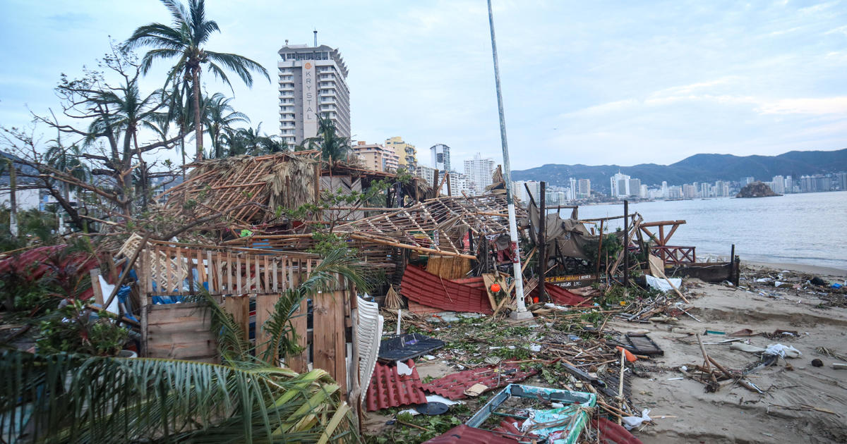
Broken windows. Streets filled with mud. An urgent hunt for the people who are missing. These are the consequences of one of the worst storms to strike Acapulco in many years.
The fury and
Rapid intensification of Hurricane Otis
The unexpected event surprised both predictors and specialists in hurricanes.
In just one day, the wind speeds increased by 115 mph, a much faster rate than expected. According to the National Hurricane Center, this was the second highest intensification rate ever recorded in modern history, leading them to label it a “nightmare scenario.”
A new study was recently published in Scientific Reports.
According to the study written by Andra J. Garner, Ph.D., the analyses indicate that there is a growing likelihood of storms intensifying at a faster rate in certain areas over time. These regions include the tropical eastern Atlantic, the U.S. East Coast, and the southern Caribbean Sea.
2007 saw four hurricanes form in the Atlantic simultaneously
According to the research, the increase in severe storms can be attributed to a warming planet. In 2023, there were unusually high surface temperatures in the ocean, with Hurricane Otis encountering 88-degree water before making landfall in Mexico. The same trend was observed in 2007, when four hurricanes developed simultaneously in the Atlantic.Hurricane Idalia
In August, the hurricane quickly grew in intensity, going from a Category 1 to a Category 4 before making landfall on the Florida coast.
According to Richard Knabb, a meteorologist from The Weather Channel and former director of the National Hurricane Center, the warm ocean, Caribbean Sea, and Gulf of Mexico serve as the primary source of energy for hurricanes. Without them, hurricanes would not be as intense.
NOAA is utilizing drones in the sky, on the sea, and beneath the ocean’s surface to enhance their ability to forecast potential rapid intensification events.
According to Knabb, the ocean can be seen as the fuel source for a hurricane, which acts as the engine. The more warm water it has access to, the faster it can accelerate and reach its maximum speed. The hurricane uses this energy from the ocean to create low pressure, which ultimately produces strong winds.
Scientists at the National Oceanic and Atmospheric Administration (NOAA) are utilizing artificial intelligence (AI) to efficiently analyze the collected data.
2017’s Hurricane Harvey.”
“Knabb stated that the use of artificial intelligence is being explored in order to sort through the abundance of information from prediction models. This will assist us in creating more knowledgeable human forecasts, taking into account the high level of uncertainty. A large portion of the nation is at risk for effects inland, which can result in severe flooding that has the potential to submerge entire communities, as evidenced by the devastation caused by Hurricane Harvey in 2017.”Ida
Strong winds, similar to those experienced in Ohio during Hurricane Ike’s landfall in 2008, can also occur in inland regions of California. This is due to the impact of the storm that originated in the Gulf of Mexico.Hurricane Hilary earlier this year. ”
The progress made in technology was not enough to prepare the residents of Acapulco for the impact of Hurricane Otis. Even two days after it hit, many are still without electricity or means of communication. The destruction of infrastructure has hindered officials from accurately assessing the scope of the devastation.
Meteorologists are currently monitoring the ocean closely to anticipate future developments. The Atlantic hurricane season continues until November 30th.
Source: cbsnews.com